

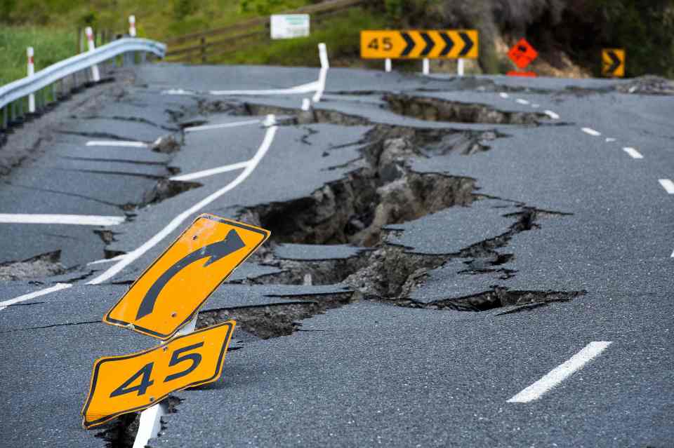
Incredible images show how the New Zealand earthquake has created a 15ft natural wall across the countryside
The quake caused extensive damage on the South Island after hitting Kaikoura, north of Christchurch, earlier this month

These incredible pictures show how a 15ft-high natural wall has formed in the New Zealand countryside after a 7.8 magnitude earthquake struck two weeks ago.
The quake caused extensive damage on the country's South Island after hitting Kaikoura, 600 miles north of Christchurch, on November 14.

Scientists who were working in the area have now discovered the ground in the North Culverden Basin moved by nine metres during the powerful quake.
The team's photographs show how the tremors caused a massive wall rock formation to spring up on Mount Lyford.
Pictures of roads, fields and fencing also clearly show how sections of the earth have shifted out of line.


The University of Canterbury scientists had dug three trenches to investigate the area's Kekerengu Fault in the weeks before the earthquake.
And after returning, they found one of the trenches had ripped in half, with one side moving nine metres away from the other half.
Dr Kate Pedley took pictures showing how the green countryside had been torn apart by the earthquake - which also claimed two lives.

"The amount of associated rockfall, landslides and slumps were incredible," she said.
The team were covering an area from the western end of the Amuri Range, back across the Emu Plain and continued as far as the junction for Mt Lyford Village.
The force of the quake was so strong, one landslide even created a dam on the Leader River.


Dr Clark Fenton, a senior lecturer in engineering geology, said they had rescued a lamb from a 5ft fissure in the ground.
He said: "The fault trace was obvious from the road across the adjacent paddocks as a prominent scarp (step) marked by tears and fissures in the ground.
"Measured displacement is up to 2.2m in a horizontal direction and up to 1.5m in a vertical direction."
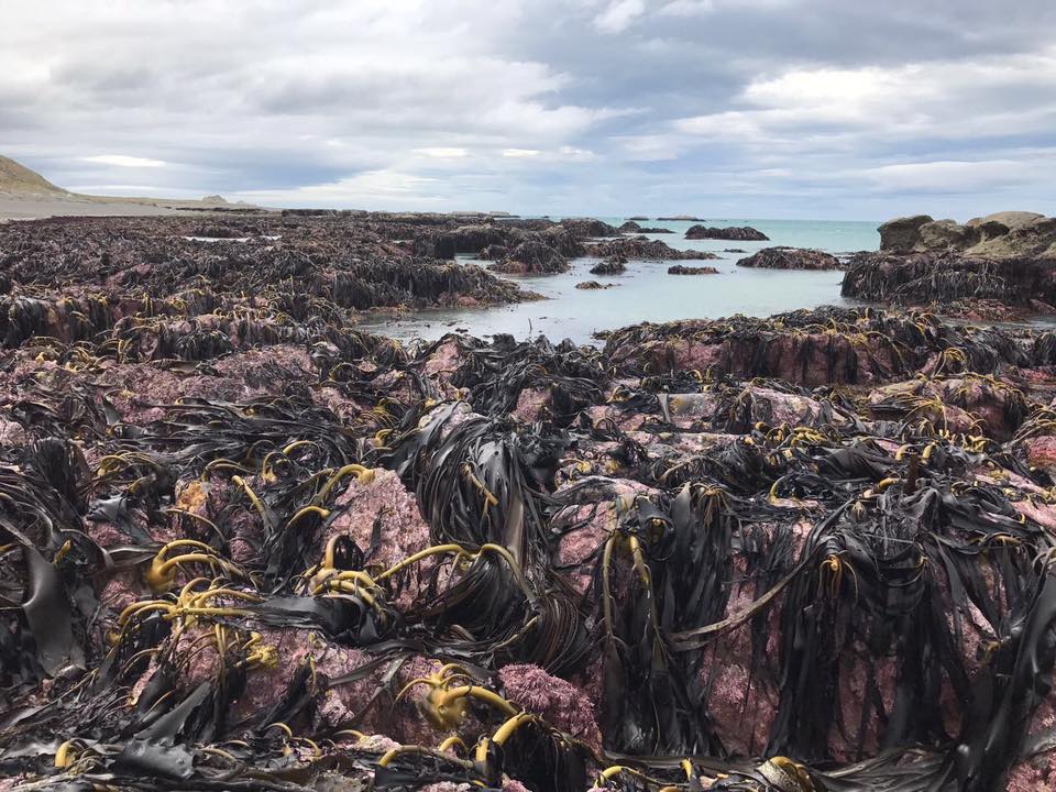
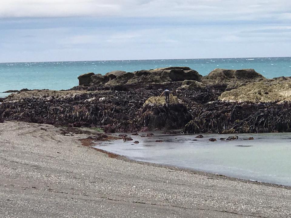
The quake has also caused the seabed to lift up by two metres in some places - a phenomena which has puzzled scientists.
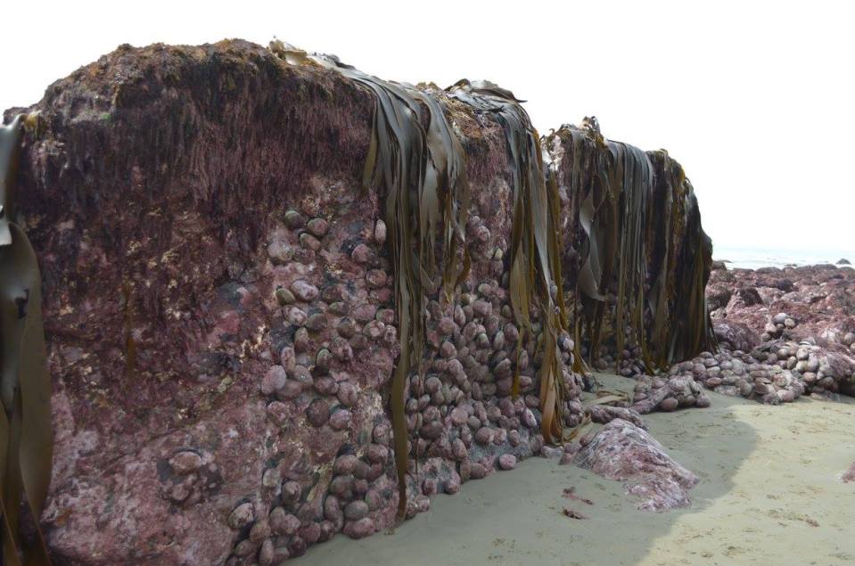
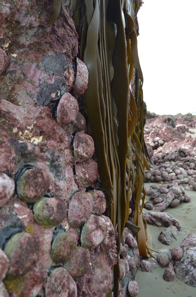
It's visible and surreal evidence of what has gone on far beneath the earth’s surface.
The damage, north of Kaikoura, has exposed the seaweed strewn rocks, pushing them onto the beach and into the open air.
They show the snail and mollusc-covered seabed now exposed metres above the ground and other sealife which won’t survive in the open air.
related stories


Experts believe it’s the first time an earthquake has resulted in the seabed around New Zealand to lift, according to Stuff.
And it provides a valuable opportunity for scientists and geologists, marine geologist Dr Joshu Mountjoy told the website.
Co-seismic movement, the seismic release of energy along a fault, was behind the phenomenon, he said.
While some faults move side-to-side, others move vertically and the after-effects from the most recent earthquake look as if they moved vertically and pushed land upwards.
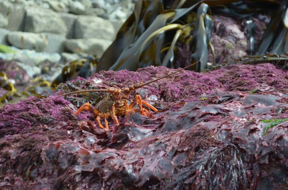
“I’ve never seen it before during an earthquake and it’s the first time we’ve seen something like this,” Mountjoy said.
"It will take a while before this becomes normal again.”
The quake has thrust up the seabed by metres in some places, meaning the whale watching boats that once plied Kaikoura Harbour may no longer be able to dock there.
The ocean floor has altered to such an extent that the impact on marine life is unclear, casting a shadow over the local fishing industry.
“It is clear that if we don’t move quickly, much of the employment in the area will dry up,” Economic Development Minister Steven Joyce said.
We pay for your stories! Do you have a story for The Sun Online news team? Email us at tips@the-sun.co.uk or call 0207 782 4368


